categories
- Traffic and Vehicles Catalogue
- socreal.catalog
- Advertisement Catalogue
- Photo Catalogue
- Chinese and Japanese Catalogue
- New Holy Card Catalogue II.
- 12 interesting old books
 Books
Books
 Bibliophil
 Antiques
 Engraving
 Maps
Maps
 Photos
 Antique Papers, Small Prints
 Posters
- Circus
- Modern Graphics
- Socialist Realism
- NER Propaganda
- Others
cart
Cart is empty
You've not logged in
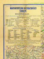
Kogutowicz Manó (Tervezte és rajzolta) : Magyarország közigazgatási térképe
- description
- additional information
(Zöld felülnyomással az 1940-ben visszacsatolt terület határvonalával)
M=1:900.000.
Méret: 115.5 x 84 cm.
Alsó sarkaiban az alábbi idézettel: „Csonka Magyarország nem ország – Egész Magyarország mennyország!”
Hajtogatva, a szélein szakadásokkal.
M=1:900.000.
Méret: 115.5 x 84 cm.
Alsó sarkaiban az alábbi idézettel: „Csonka Magyarország nem ország – Egész Magyarország mennyország!”
Hajtogatva, a szélein szakadásokkal.


 Telefon:
 E-mail:


