categories
- Traffic and Vehicles Catalogue
- socreal.catalog
- Advertisement Catalogue
- Photo Catalogue
- Chinese and Japanese Catalogue
- New Holy Card Catalogue II.
- 12 interesting old books
 Books
Books
 Bibliophil
 Antiques
 Engraving
 Maps
Maps
 Photos
 Antique Papers, Small Prints
 Posters
- Circus
- Modern Graphics
- Socialist Realism
- NER Propaganda
- Others
cart
Cart is empty
You've not logged in
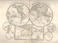
AD. Steler's Schul-Atlas über alle Theile der Erde - nach dem neuesten Zustande und über das Weltgebäude.
- description
- additional information
38. verbesserte und vermehrte Auflag.
Ausgabe für sie Österreichische Monarchie in vierzig illumin. Karten in Kupferstich.
36 Karten in Kupferstich (Blattgröße ca. 23, 5 x 29, 5 cm),
Ausgabe für sie Österreichische Monarchie in vierzig illumin. Karten in Kupferstich.
36 Karten in Kupferstich (Blattgröße ca. 23, 5 x 29, 5 cm),
| condition: |     |
| category: | Maps > Hungary > |
| category: | Maps > European country > |
| category: | Maps > Countries outside of Europe > |
| category: | Books > Foreign Language Books > Books in German > |
| publisher: | Justus Perthes, 1858. Gotha, |
| item number / ISBN: | 0043577 |
| binding: | half-leather bound |
| pages: | 36 Karten in Kupferstich (144 p.) |
| language: | German |


 Telefon:
 E-mail:


