categories
- Traffic and Vehicles Catalogue
- socreal.catalog
- Advertisement Catalogue
- Photo Catalogue
- Chinese and Japanese Catalogue
- New Holy Card Catalogue II.
- 12 interesting old books
 Books
Books
 Bibliophil
 Antiques
 Engraving
 Maps
Maps
 Photos
 Antique Papers, Small Prints
 Posters
- Circus
- Modern Graphics
- Socialist Realism
- NER Propaganda
- Others
cart
Cart is empty
You've not logged in
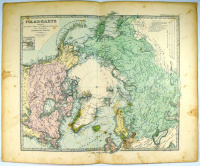
Berghaus, Hermann (térképész) : Polar-Karte enthaltend: die Länder u. Meere vom Nord-Pol bis 50° N. Br. u. weiter, sowie Übersicht des Russischen Reichs
- description
- additional information
Litográfia. Megjelent: Stieler's Handatlas 6. kiadásának egy lapjaként.
Kissé foxingos példány.
Kissé foxingos példány.
| condition: |     |
| category: | Maps > Countries outside of Europe > |
| publisher: | Gotha, 1875-1881, Justus Perthes |
| item number / ISBN: | 0060878 |
| pages: | Képméret: 327x380 mm |
| language: | German |


 Telefon:
 E-mail:


